
An Interest In:
Web News this Week
- April 3, 2024
- April 2, 2024
- April 1, 2024
- March 31, 2024
- March 30, 2024
- March 29, 2024
- March 28, 2024
Some of Our Sources
- Mashable
- Technology Review
- Just Creative
- Pearsonified
- Smashing Magazine
- Smashing Apps
- CSS Globe
- Line 25
- Web Resource Source
- Hashedout
Help Webnuz
Referal links:
Introduction to GEE, CLIMATE Engine, and Satellite Data
Contents
- Earth data
- Google Earth engine
- Climate Engine
Earthdata:
Is the home for full and open access to NASA's Earth science data collections, accelerating scientific advancement for societal benefit.
Google Earth Engine:
Is a geospatial processing service. With Earth Engine, you can perform geospatial processing at scale, powered by the Google Cloud Platform. The purpose of Earth Engine is to: Provide an interactive platform for geospatial algorithm development at scale.
Climate Engine:
The Climate Engine enables users to quickly process and visualize satellite earth observations and gridded weather data for environmental monitoring and to improve early warning of drought, wildfire, and crop-failure risk. Instead of processing entire archives, focus on data discovery and answers.

The figure above shows the remote sensing workflow that one needs to follow for their end-to-end projects and illustrates that we can download data all at once and then focus on the type of problem we are trying to solve in data science.
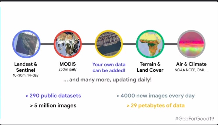
GEE has alot of datasets ranging from using satellites like Landsat, Copernicus, NOOA, and MODIS.among these the data is either updated daily as for modis,others maybe weekly while others are monthly.
According the GEOFORGOOD2019 we have 290 public datasets which means 5 million images.
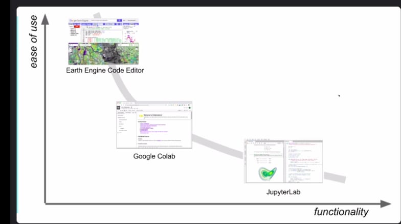
The image represents the ease of use of the platforms to perform geospatial calculations. Javascript editor is the fastest in computation as it is cloud-based. Python comes second and we need to prefer Google Colab as its the second in the hierarchy.
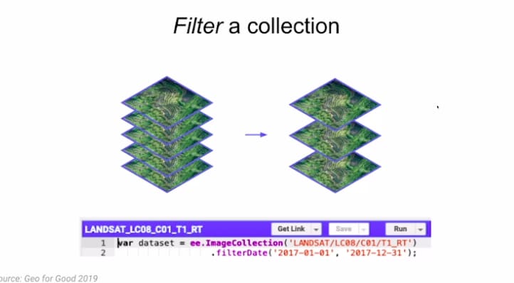
As we have many images over the years it would be important as a geospatial data scientist to make sure you filter your images to only the required period, in this case, we use filterdate , command as shown below.
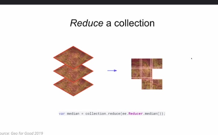
Again we can reduce images either by mean or median which would work well if you have a large coverage area.
We can also have optical or synthetic images
Synthetic Imaging is the creation of two-dimensional optical images by means of mathematical modeling computations of compiled data rather than by the more traditional photographic process of using light waves focused through cameras or other optical instruments.
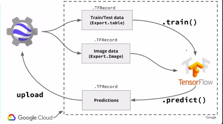
GEE API & Machine Learning
We have different classifiers to do classification, regression, and clustering EE. Here is the list.

If you are using tensorflow for either academic or commercial use you will have to pay or rather it will come at a cost since it uses GCP assets.
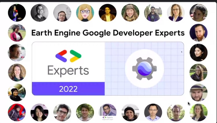
Google Eart Engine Experts
Who is a GEE expert?
Google Developers Expert is a person recognized by Google as having exemplary expertise in web technologies or Google Developers product.
Google usually has different categories of experts from Android, web,machine learning,GEE etc.
The list below shows the first GEE experts in 2022.
Process Of Becoming a GEE Expert
- Nomination by anyone in the Google team.
- Screening
- Interviews
- Announcement
Credits Keiko Nomura, PhD ,Director Of Science Applications, SpatiaFi
Thank you!
Original Link: https://dev.to/geedevs-nairobi/introduction-to-gee-climate-engine-and-satellite-data-2l7c
Dev To
More About this Source Visit Dev To