An Interest In:
Web News this Week
- April 27, 2024
- April 26, 2024
- April 25, 2024
- April 24, 2024
- April 23, 2024
- April 22, 2024
- April 21, 2024
Some of Our Sources
- Slashdot
- Pearsonified
- FanExtra - PSD
- Crazy Leaf Design
- Fudge Graphics
- CSS Tricks
- Design Modo
- Web Resource Source
- Daily Now
- The Verge
Help Webnuz
Referal links:
May 3, 2016 05:36 am PDT
Original Link: http://feeds.boingboing.net/~r/boingboing/iBag/~3/yrGfvnnWVuU/mapbox-up-to-date-satellite-i.html
Mapbox: up-to-date satellite imagery
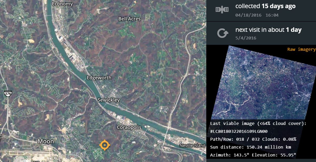
Google Maps and similar services are most useful, but who has the most recent space footage of your neighborhood? Check out mapbox, a Landsat viewer that tells you when the satellite image you're looking at was taken, and when a new snap is scheduled. The zoom level really isn't useful for anything at a life-lived level – with the exception of recent weather, disasters, etc – but all services should expose metadata like this.
Original Link: http://feeds.boingboing.net/~r/boingboing/iBag/~3/yrGfvnnWVuU/mapbox-up-to-date-satellite-i.html
Share this article:
Tweet

View Full Article