
An Interest In:
Web News this Week
- April 1, 2024
- March 31, 2024
- March 30, 2024
- March 29, 2024
- March 28, 2024
- March 27, 2024
- March 26, 2024
Some of Our Sources
- Simplebits
- Web Designer Wall
- Just Creative
- The Logo Smith
- Spoon Graphics
- Inspiredology
- FanExtra - PSD
- Stylized Web
- Willems Lab
- Hashedout
Help Webnuz
Referal links:
Deepfake satellite imagery poses a not-so-distant threat, warn geographers
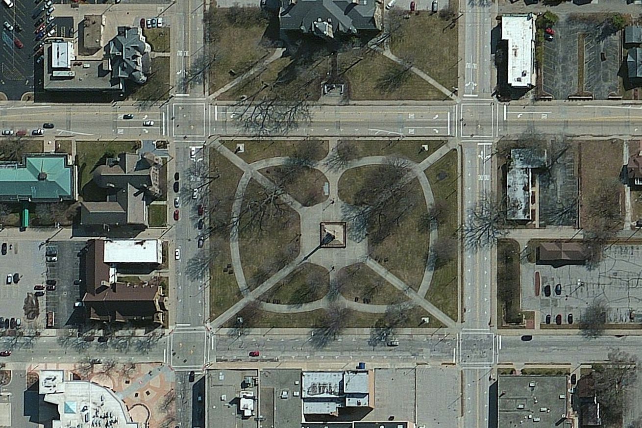
When we think of deepfakes, we tend to imagine AI-generated people. This might be lighthearted, like a deepfake Tom Cruise, or malicious, like nonconsensual pornography. What we don’t imagine is deepfake geography: AI-generated images of cityscapes and countryside. But that’s exactly what some researchers are worried about.
Specifically, geographers are concerned about the spread of fake, AI-generated satellite imagery. Such pictures could mislead in a variety of ways. They could be used to create hoaxes about wildfires or floods, or to discredit stories based on real satellite imagery. (Think about reports on China’s Uyghur detention camps that gained credence from satellite evidence. As geographic deepfakes become widespread, the...
Original Link: https://www.theverge.com/2021/4/27/22403741/deepfake-geography-satellite-imagery-ai-generated-fakes-threat
The Verge
More About this Source Visit The Verge