
Some of Our Sources
- BoingBoing
- Engadget
- Mashable
- Technology Review
- TutsPlus - Code
- Joshua Blankenship
- Six Revisions
- Wal You
- Web Resource Source
- Android Dissected
Help Webnuz
Referal links:
Do you know GeoJSON ?
Introduction
For those who don't know, GeoJSON is the standard data format used to store location data and geographical features.
Contents
- Terminologies
- Different Geometry types
- Resources
GeoJSON is just a JSON object. What makes them a different datatype from plain JSON is its specifications.
Some databases like Mongo DB has official support for GeoJSON data type. Just like how MongoDB identifies String and Integer types, it identifies and differentiates GeoJSON from normal JSON. It comes with support for indexing and querying GeoJSONs
In this post, I will cover some of basic concepts of the GeoJSON data type.
A typical GeoJSON looks like this.
Don't get overwhelmed, we have discussed everything below.
{ "type": "Feature", "properties": {}, "geometry": { "type": "Point", "coordinates": [-40.078125,70.72897946208789] }}Terminologies
Coordinates
A single point in the map is called a coordinate
When we are pointing at a location on the map, we are pointing to some longitude and latitude units. We store these sets of units in an array called coordinates.
A coordinates array contains two elements longitude and latitude
NOTE: the order is importantcoordinates : [ longitude , latitude ]
Geometry
Think of geometry as structures. A Geometry defines in what structure the coordinates are stored.
There are certain predefined case-sensitive types of geometry, namely 'Point', 'Line', 'Polygon', and more. We will see them one by one.
A typical geometry looks like below
"geometry": { "type": "Point", "coordinates": [longitude,latitude]}"type"
Every geometry must have a property called "type" whose value must only be one of the GeoJSON types mentioned in the GeoJSON RFC
There are some geometry types that are used to store other geometry types. They are "Feature" and "FeatureCollection" we have discussed about them below.
Geometry Types
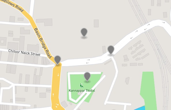
Point
A point is a single point or marker on the map. Its geometry contains a single coordinate. This may be used to store individual place like a store.

"geometry": { "type": "Point", "coordinates": [ 78.4918212890625, 22.304343762932216 ] }MultiPoint
As you have guessed by the name, a MultiPoint geometry is used to store multiple points of coordinates in a single geometry. Each element in the coordinates array is itself a coordinate. This may be used to store list of favorite places.
{ "type": "MultiPoint", "coordinates": [ [80.26951432228088,13.09223800602329], [80.27061939239502,13.091631907724683], [80.2714991569519,13.09260375427521], [80.27050137519836,13.093241199930675] ]}LineString
They are a line of points. The JSON structure is the same as that of MultiPoint but since this is of type LinePoint, individual coordinates are treated as a connected line rather than points lying around distinctly.

"geometry": { "type": "LineString", "coordinates": [ [80.2122116088867,13.113586344333864], [80.25959014892577,13.072121016365408], [80.29048919677733,13.114923819297273], [80.3207015991211,13.075799674224164], [80.33477783203125,13.112248862097216] ]}MultiLineString
As the name states it is used to store more than one LineString in a single geometry. Each element of the Coordinates array is like a single LineString Coordinates array.
"geometry":{"type": "MultiLineString","coordinates" : [[[longitude,latitude],[longitude,latitude],[longitude,latitude] ],[[longitude,latitude],[longitude,latitude],[longitude,latitude] ],[[longitude,latitude],[longitude,latitude],[longitude,latitude] ],]}Polygon
The RFC specification defines polygons are linear rings, in case you are wondering what's a linear ring, so was I.
Let me put it this way, polygons are any shape which is closed, yes literally any shape. In the coven image of this post each letter is a polygon.
If you understood LineStrings, the RFC specification also defines polygons are closed LineString i.e a polygon is any shape that is closed. A closed LineString means the first and the last coordinate will be the same.
This may be used to store borders. May it be country's border, city, village or an area's border.

"geometry": { "type": "Polygon", "coordinates": [ [ [78.44238281249999,22.62415215809042], [77.8436279296875,22.151795575397756], [78.486328125,21.764601405743978], [79.0521240234375,22.233175265402785], [78.44238281249999,22.62415215809042] ] ]}MultiPolygon
By this time you should have guessed, same like MultiPoint and MultiLine, MultiPolygon is a collection of Polygons. You can use this to store border information of different cities in a state.
The cover image of this post can be an example of MultiPolygon
Feature and FeatureCollection
Here comes the juice. Now you learned about how to store geographical data in various structures like Points, Lines, and Polygons. Now how do you store information for those locations?
The proper way to store geographical information is by using Feature and FeatureCollection.
GeoJSON Feature and FeatureCollections are geometry themselves. They are a kind of geometry that is used to store other geometry and properties (information) about that geometry.
A typical Feature looks like this
{ "type": "Feature", "geometry": { "type": "Point", "coordinates": [-10.0,-10.0] }, "properties": { "temperature": "4C", "country": "IN", "somepropertyName": "Some description" }}In the above GeoJSON, the geometry can be any of the types we discussed earlier like Point, Line, or Polygon and the properties contain data and information about that geometry.
FeatureCollection
As the name suggests a FeatureCollection GeoJSON contains a collection of Features.

{ "type": "FeatureCollection", "features": [ { "type": "Feature", "properties": {}, "geometry": { "type": "Point", "coordinates": [78.31054687499999,22.39071391683855] } }, { "type": "Feature", "properties": {}, "geometry": { "type": "Point", "coordinates": [78.486328125,11.43695521614319] } }, { "type": "Feature", "properties": {}, "geometry": { "type": "Point", "coordinates": [77.9150390625,27.176469131898898] } }, { "type": "Feature", "properties": {}, "geometry": { "type": "Point", "coordinates": [75.673828125,19.766703551716976] } } ]}Resources
RFC secification for GeoJSON
https://tools.ietf.org/html/rfc7946Interactive hands on with GeoJSON
https://geojson.io/Best JS Map Library
Leaflet.js
Original Link: https://dev.to/ashiqsultan/do-you-know-geojson-4gld
Dev To
More About this Source Visit Dev To