An Interest In:
Web News this Week
- April 4, 2024
- April 3, 2024
- April 2, 2024
- April 1, 2024
- March 31, 2024
- March 30, 2024
- March 29, 2024
Some of Our Sources
- Technology Review
- Smashing Apps
- TutsPlus - Design
- Crazy Leaf Design
- My Ink Blog
- 24 Ways
- Stylized Web
- Wal You
- Dev To
- Hashedout
Help Webnuz
Referal links:
April 6, 2017 06:08 pm PDT
Original Link: http://feeds.boingboing.net/~r/boingboing/iBag/~3/3ch7lvE1IvI/inuit-cartography-maps-carved.html
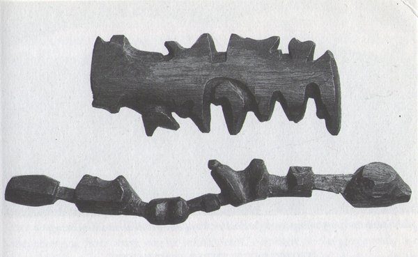
Inuit cartography: maps carved in driftwood
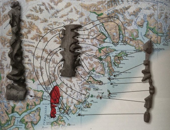
The Inuit carve portable, waterproof, floating maps out of driftwood for use in navigating the littoral.
These three wooden maps show the journey from Sermiligaaq to Kangertittivatsiaq, on Greenlands East Coast. The map to the right shows the islands along the coast, while the map in the middle shows the mainland and is read from one side of the block around to the other. The map to the left shows the peninsula between the Sermiligaaq and Kangertivartikajik fjords.
From The Decolonial Atlas, an antidote to all the other ones: Kurdistan in Kurdish, Lakota Territory, Agricultural Maps.
Original Link: http://feeds.boingboing.net/~r/boingboing/iBag/~3/3ch7lvE1IvI/inuit-cartography-maps-carved.html
Share this article:
Tweet

View Full Article